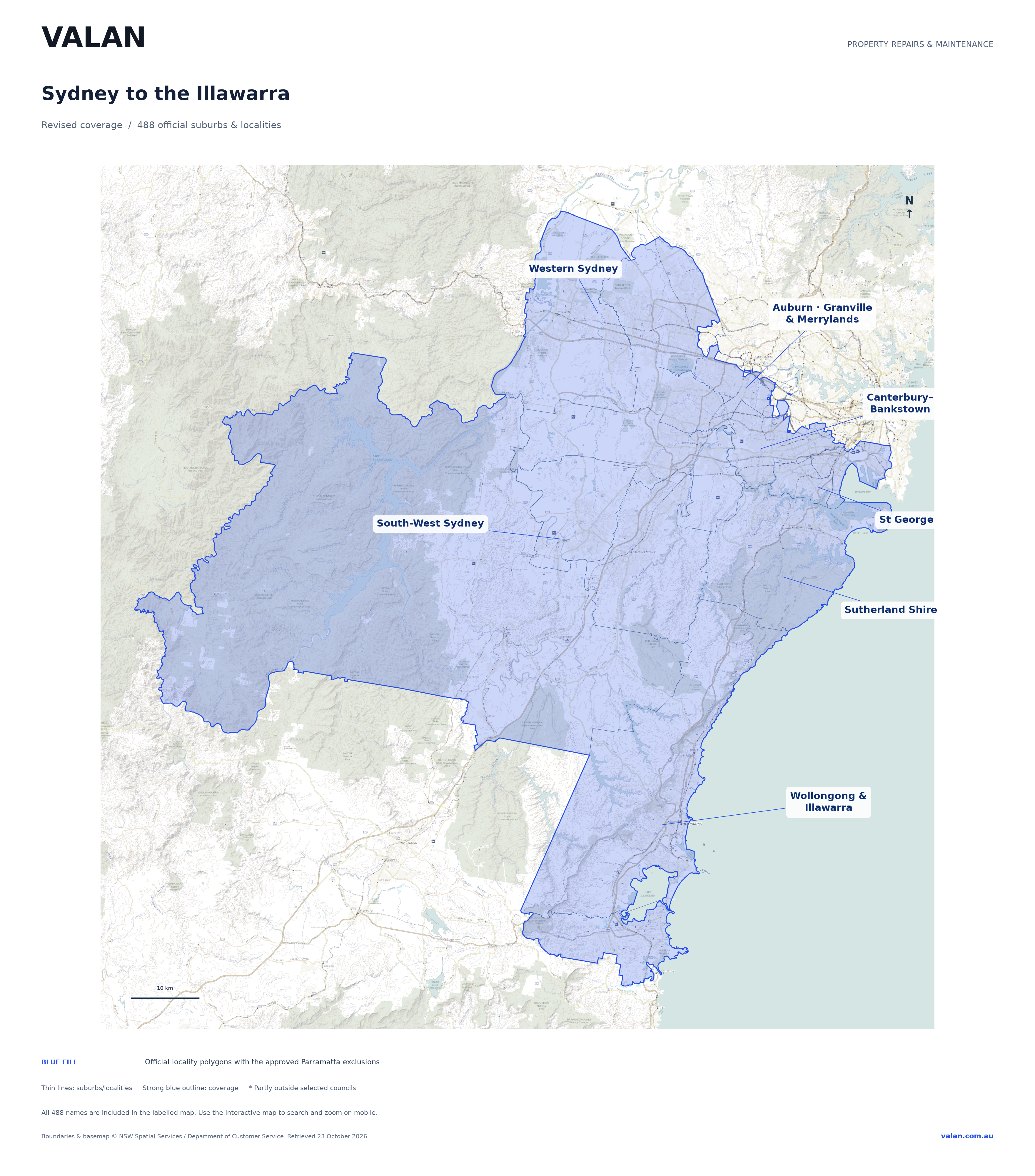
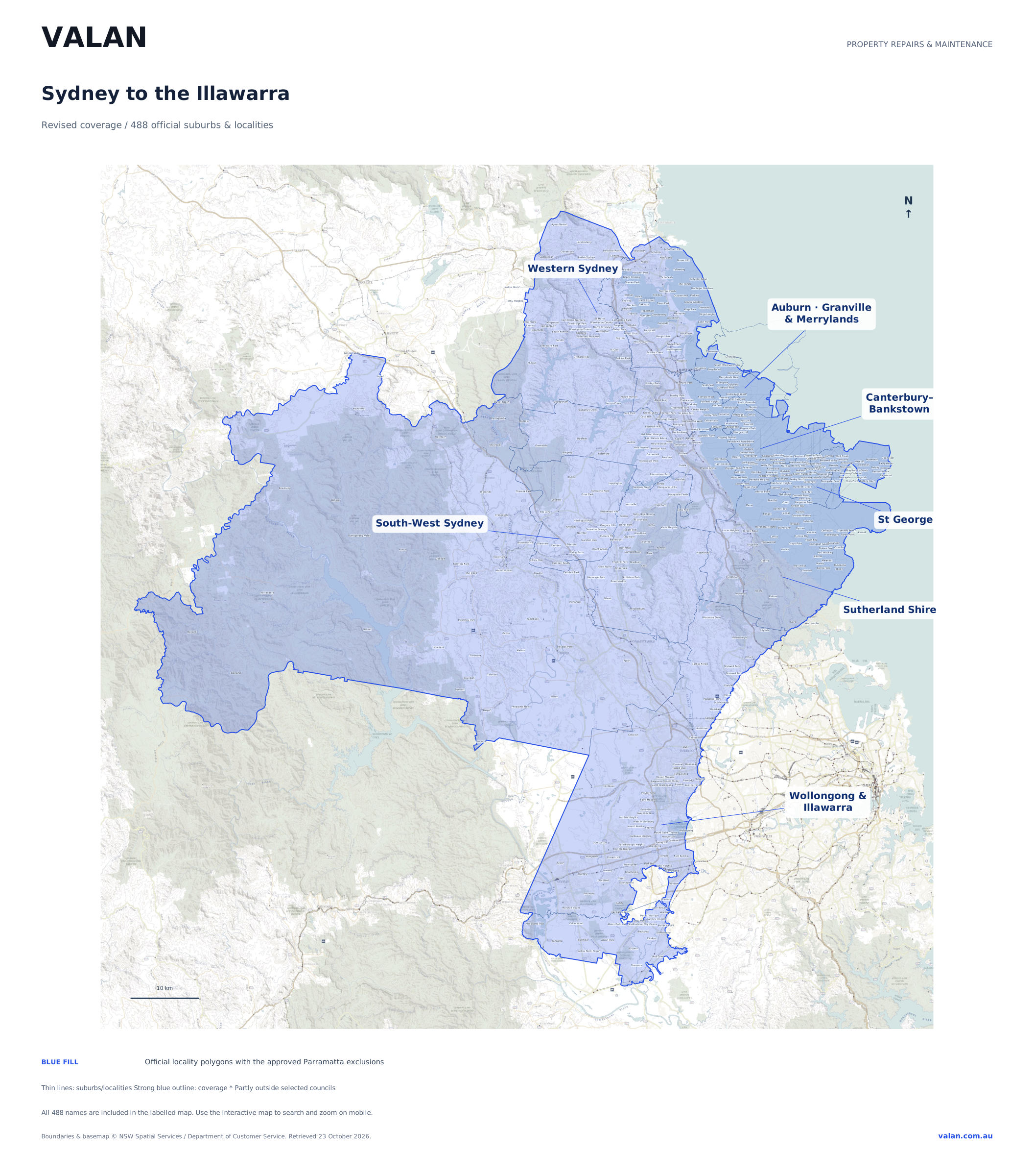
The approved inventory contains 488 unique suburbs and localities, revised on 23 October 2026. It uses official NSW Spatial Services suburb and council boundaries.
From the original City of Parramatta locality list, only Auburn, Granville and Merrylands remain. The other 37 names were removed from every selected council’s coverage. Parramatta CBD is excluded. Other approved coverage remains, including South Granville, Guildford, Guildford West, Chester Hill and Woodpark. No Woodville Road distance buffer has been added.
Regional labels are for orientation. The mapped locality polygons define the coverage. A locality crossing into an unselected council may be only partly covered; select it to see the included boundary and its council information.
Boundaries were retrieved on 23 October 2026 from the NSW Spatial Services Suburb layer and LocalGovernmentArea layer. Road and background context comes from the NSW Base Map.
The supplied methodology retains source-data gaps and leaves uncovered water areas unfilled. The original overlay uses a one-square-metre inclusion tolerance, and the interactive coordinates are rounded to eight decimal places without simplifying boundaries. The map is not a claim of complete coverage of every council or street, and does not guarantee access or suitability for every job.
When live road tiles are unavailable, the saved NSW basemap remains available with the approved boundaries, search and labels.
© NSW Spatial Services / NSW Department of Customer Service. The map uses Leaflet; its licence is included.
Alphabetical suburb list · Council breakdown · Overview PNG · Labelled SVG